
Littleton ZIP Coverage at a Glance
The City of Littleton ZIP table separates standard ZIPs, USPS place names, counties, and type. It starts a ZIP search, but the city or county must still return the address jurisdiction. A post-office or routing label is a clue, not proof of an incorporated parcel.
| ZIP | Areas Covered | Post Office | Notes |
|---|---|---|---|
| 80120 | Littleton, Arapahoe County | Littleton station | Completely within Littleton city limits; standard ZIP; no other USPS names shown. |
| 80121 | Littleton, Greenwood Village, Centennial; Arapahoe County | LITTLETON 80121 routing label | Partial within Littleton; standard ZIP. |
| 80122 | Littleton and Centennial; Arapahoe County | LITTLETON 80121 routing label; Centennial station clue | Partial within Littleton; standard ZIP. |
| 80123 | Littleton, Bow Mar, Columbine Valley, Denver, Lakewood; Arapahoe and Jefferson Counties | LITTLETON 80123 routing label; Columbine Hills clue | Partial within Littleton; standard ZIP. |
| 80124 | Highlands Ranch and Lone Tree; Douglas County | LITTLETON 80126 routing label | Outside Littleton city limits; standard ZIP. |
| 80125 | Roxborough; Douglas County | LITTLETON 80128 routing label | Outside Littleton city limits; standard ZIP. |
| 80126 | Highlands Ranch; Douglas County | LITTLETON 80126 routing label | Outside Littleton city limits; standard ZIP. |
| 80127 | Littleton and TrailMark; Jefferson County | LITTLETON 80128 routing label; Ken Caryl Ranch clue | Partial within Littleton; standard ZIP. |
| 80128 | Littleton; Arapahoe and Jefferson Counties | LITTLETON 80128 routing label | Partial within Littleton; standard ZIP; no other USPS names shown. |
| 80129 | Highlands Ranch; Douglas County | LITTLETON 80129 routing label | Outside Littleton city limits; standard ZIP. |
| 80130 | Highlands Ranch; Douglas County | LITTLETON 80129 routing label | Outside Littleton city limits; standard ZIP. |
| 80160-80163 | Littleton PO Box products in Arapahoe and Jefferson contexts; 80163 is tied to Highlands Ranch and Douglas County | Littleton PO Box routing | PO Box ZIPs, not street-parcel locations. |
| 80165 | Arapahoe, discontinued entry | Discontinued routing entry | Discontinued building-type notation; not a current street-parcel location. |
In short, 80120 is completely within Littleton and Arapahoe County; 80121, 80122, 80123, 80127, and 80128 are partial; and 80124, 80125, 80126, 80129, and 80130 are outside city limits. Keep PO Box and discontinued entries separate from street results.
Littleton ZIP Codes Are Postal Clues
The official Littleton ZIP Codes table says USPS Littleton reaches places in Arapahoe, Jefferson, and Douglas Counties. Postal geography answers delivery, city GIS answers incorporation, and county parcel systems answer record custody. A mailing city cannot stand in for municipal jurisdiction.
Start with the Littleton Address Wizard. Enter the address as given, review the returned jurisdiction, and follow its parcel-wizard link when the result points outside Arapahoe County. Keep mailing city, ZIP, county, and parcel ID separate.
The USPS ZIP Code basics reference explains the delivery-unit idea behind the postal side of the Littleton directory.
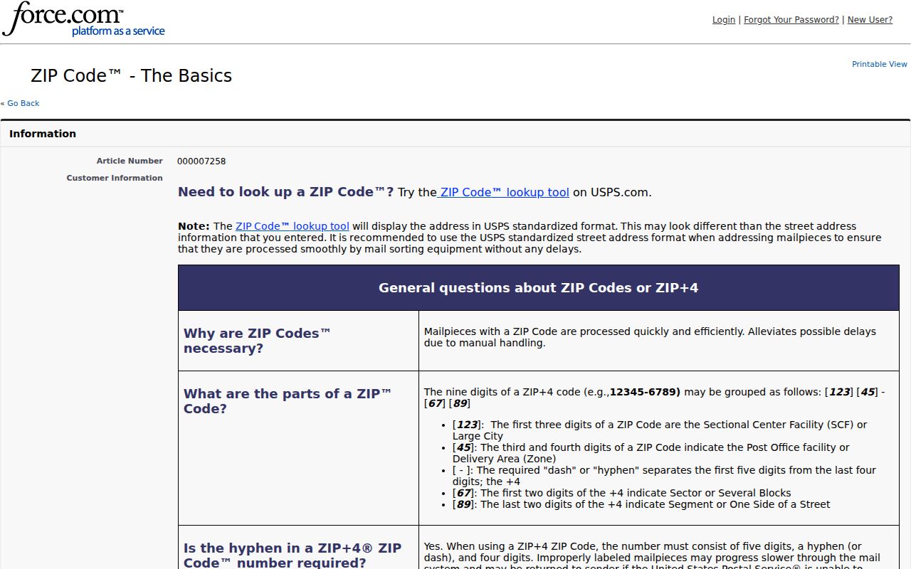
Boundary check. A ZIP or post-office label routes mail. The Address Wizard and parcel GIS decide the municipal and county context for a specific address.
80120 and Littleton's Partial ZIP Areas
ZIP 80120 is the cleanest local example: the city table lists it as completely within Littleton city limits and Arapahoe County, with no other USPS names shown. Check the exact address anyway because assessor and GIS systems distinguish situs from mailing address.
The partial group needs more care. ZIP 80121 includes Greenwood Village and Centennial; 80122 includes Centennial; and 80123 reaches Bow Mar, Columbine Valley, Denver, and Lakewood across Arapahoe and Jefferson Counties. ZIP 80127 includes TrailMark in Jefferson County, while 80128 is partial across Arapahoe and Jefferson Counties. These are search clues, not proof of incorporation.
Littleton ZIP Codes Outside City Limits
ZIPs 80124, 80125, 80126, 80129, and 80130 are listed outside Littleton city limits in Douglas County. They cover Highlands Ranch and Lone Tree in 80124, Roxborough in 80125, and Highlands Ranch in 80126, 80129, and 80130. A LITTLETON routing label does not move a parcel into Littleton.
ZIPs 80160, 80161, and 80162 are Littleton PO Box products in Arapahoe and Jefferson contexts; 80163 is tied to Highlands Ranch and Douglas County. ZIP 80165 is discontinued with an Arapahoe building-type notation. None locates a street parcel by itself.
- ZIP and ZIP+4
- ZIP routes the main delivery area. ZIP+4 refines USPS delivery; neither sets a city limit.
- PO Box ZIP
- A box-delivery postal product. It routes mail without identifying a street parcel.
- Unique ZIP
- A ZIP for one organization or delivery point, not a broad street area or municipal boundary.
- Carrier route
- A delivery sequence inside a ZIP, not a city, county, parcel, or custodian boundary.
Littleton ZIP Routing Labels and Post Offices
USPS sorting examples group ZIPs under routing labels: 80120, 80160, and 80165-80166 under LITTLETON 80120; 80121, 80122, and 80161 under LITTLETON 80121; 80123 and 80162 under LITTLETON 80123; 80124, 80126, and 80163 under LITTLETON 80126; 80125, 80127, and 80128 under LITTLETON 80128; and 80129 and 80130 under LITTLETON 80129.
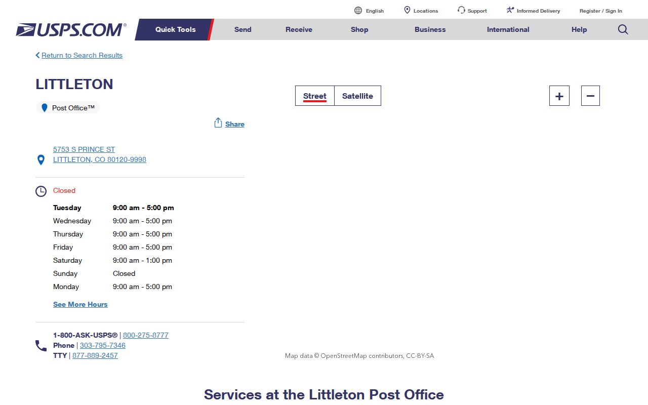
- Littleton station: 5753 S Prince St, Littleton, CO 80120-9998.
- Centennial clue: 2221 E Arapahoe Rd, Centennial, CO 80122-9998.
- Columbine Hills clue: 6698 S Iris St, Littleton, CO 80123-3180.
- Ken Caryl Ranch clue: 8200 Shaffer Pkwy, Littleton, CO 80127-9997.
These locations show service overlap, not boundary lines. Use the city table, Address Wizard, and parcel GIS for jurisdiction.
The Littleton USPS location record supplies a current station clue for ZIP delivery research.
Finding Littleton Residents by ZIP Code
A ZIP narrows a search, but it does not identify every current resident. A tax owner, deed party, directory entry, or voter row can describe a different role or date. Confirm the address and source role before treating a name as a resident lead.
- Preserve the street line, unit, city, ZIP, and any ZIP+4. Use the USPS ZIP Lookup to check delivery formatting and place name.
- Compare the result with the Littleton ZIP table. Mark the ZIP as complete, partial, outside city limits, PO Box, or discontinued.
- Run the same address through the Address Wizard. Save its city-limit result, county, map result, and any linked parcel-wizard route.
- Use the assessor or GIS portal to obtain an AIN, PIN, situs address, and parcel context. Do not assume that the county tool has a ZIP filter when its captured fields do not show one.
- For a registration-status question, use the Colorado voter lookup with the required name, ZIP, and birthday fields. Treat a no-hit as a limit of that lookup, not proof that a person is absent.
When a ZIP narrows the search to a street, the Littleton by-street records can take over for street-level parcel work. Keep the original returned city name.
Littleton Assessor and GIS ZIP Cross-Checks
Arapahoe County tools are strong parcel cross-checks, but the documented forms do not use ZIP as the main key. The assessor accepts an identifier or address, while GIS accepts an address or parcel ID. ZIP is a comparison clue, not a parcel identifier.
| Portal | Field or control | ZIP research use |
|---|---|---|
| Arapahoe assessor | AIN, formatted as 0000-00-0-00-000 | Preserve leading zeroes and hyphens; use the stable parcel bridge. |
| Arapahoe assessor | PIN, up to 16 numeric characters | Use the numeric parcel ID; the interface adds hyphens when appropriate. |
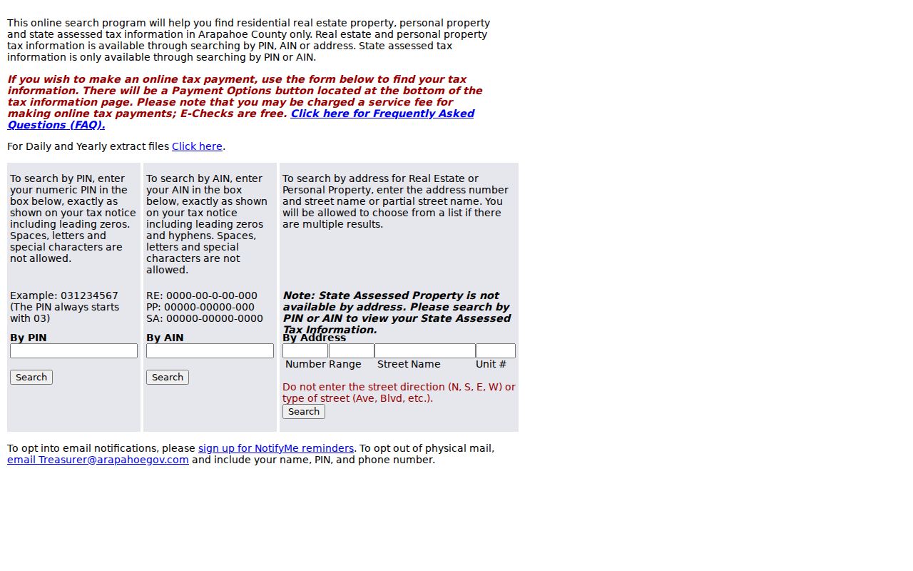
| Arapahoe assessor | Number, Range from/to, Street Name, Unit | Street name needs at least three characters; no separate city, state, or ZIP field was observed. |
| GIS Location Info | Street address; Find address | City, state, and ZIP are not required; compare the returned jurisdiction. |
| GIS Location Info | Parcel ID/PIN; Find parcel | Use a known parcel identifier when an address has multiple records or a large parcel. |
| ArapaMAP | Full or partial AIN/PIN; Locate | Compare parcel geometry, layers, and date; retain the centroid caveat. |
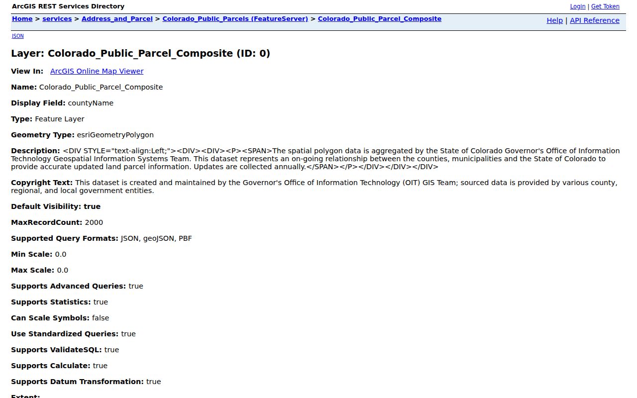
| State parcel service | situsAdd, ownerAdd, landAcres | Compare counties and street fields; check the service refresh date before relying on a result. |
The assessor route includes 5334 S Prince St, 303-795-4600, assessor@arapahoegov.com, and county requests for records not online. If the Wizard returns Jefferson or Douglas, use that county's parcel system. An address-change form changes mailing information, not title proof.
The assessor interface did not expose a current owner-name search in the reviewed capture. A tax result can show the tax-maintained owner name, situs, PIN or AIN, taxable value, tax rate, assessed tax, due dates, and exemptions or credits. It is not a deed chain or proof of current occupancy.
The Arapahoe tax search shows the tax-report layer that can sit beside a ZIP match.
Littleton Voter ZIP Lookup and Requests
The Colorado Secretary of State lookup is a name-and-ZIP status route, not a ZIP-wide resident export. It requires First Name, Last Name, ZIP, and Birthday in mm/dd/yyyy order. Names must match the registration record. Confidential records and people under 18 may not appear; after a move, try a prior home ZIP.
Arapahoe County Elections provides a second channel through its public voter lists page. The basic active list is a no-cost raw comma-delimited file described as updated each weekday except holidays. District, voter-history, ballot, cure, and custom-list products are also described.
- Custom-list pricing was $25 for text, $35 for Excel, and $0.25 per printed page.
- Arapahoe Elections: 5334 S Prince St, Littleton; 303-795-4511; fax 303-794-4625; elections@arapahoegov.com; weekdays 8 to 4.
- Appointments use the county scheduling route; confirm current files, criteria, prices, and dates.
The statewide voter-data request PDF asks for requester, address, city, state, ZIP, phone, email, dates, pickup, signature, amount, copies, and product choice. Payment runs through the Colorado Secretary of State Elections Division. Protected fields remain restricted.
Littleton ZIP Mismatches and County Logic
A reliable answer joins USPS delivery place, city GIS jurisdiction, county, parcel ID, and record custodian. Those layers can disagree without any one being wrong. Littleton reaches portions of Arapahoe, Jefferson, and Douglas Counties, while postal Littleton reaches beyond the incorporated boundary.
The statewide Colorado public parcel service compares street and owner-address fields across county data. Its situsAdd, ownerAdd, and landAcres fields support a second spatial check. Keep the query date and refresh information. It does not turn a ZIP into a city boundary authority.
The statewide parcel service provides a comparison layer when a Littleton ZIP result crosses county context.
Mismatch rule. If a portal returns another city or county, preserve the returned string. Do not silently normalize it to Littleton or use a post-office label as boundary proof.
Littleton ZIP Requests Need Every Locator
When an online result is missing, ask the custodian for a narrow search. A Colorado Open Records Act request can reach a public county or city record, but it does not replace a deed index or override a protected voter field. Name the record type and format.
- Give the street number, direction, name, type, unit, ZIP, city, and county exactly as supplied.
- Add the parcel ID, PIN, AIN, or reception, book, page, and legal-description clue.
- State the record type, date range, requested field, and copy, inspection, or file format.
- Identify the returned city and county, especially for 80121-80123, 80127-80128, and PO Box ZIPs.
- Save the request date, source URL, response, and custodian correction.
For a parcel question, start with the Arapahoe assessor or GIS office. For instruments, use the Arapahoe County Clerk and Recorder or the appropriate Jefferson or Douglas office. For registration, use Elections. Keep every locator and mismatch with the request.
Lawful personal use. ZIP and parcel research can support family history, reconnecting, property curiosity, and civic work. Do not use a public record to stalk, harass, intimidate, or harm anyone.