
Trace a Littleton Street Address
Start with the exact address string, including direction, street type, unit, and ZIP. The first question is jurisdiction. Littleton’s home-rule boundary can differ from a mailing label, leading to Arapahoe, Jefferson, or Douglas County records. Once confirmed, the parcel ID bridges an assessor result, GIS map, tax report, and recorded instrument. A name found in one source is a lead, not proof of residence.
The practical chain is address -> jurisdiction -> parcel -> owner or recorded party -> voter or directory clue. Keep the source date beside each result.
- Run the address through the Littleton Address Wizard. Note the city-limit result, county, map point, and any linked parcel wizard.
- Compare the address in Arapahoe GIS Location Info. Save the returned parcel ID or PIN, and follow the Jefferson or Douglas system when the city result points outside Arapahoe.
- Use the assessor address form, AIN, or PIN to confirm the parcel and tax-side owner fields. Review multi-unit or multi-part results instead of accepting the first row without checking it.
- Use Arapahoe PublicSearch for the deed chain. Then use the Colorado voter lookup or county voter files for registered-voter evidence, subject to confidential-record limits.
- Compare the address with Littleton directories, criss-cross material, maps, and surveys when the question reaches into the past.
Littleton Street Directory Records
A street-by-street search works because each custodian attaches different facts to the same location. The assessor and tax systems describe a parcel and its assessment. GIS adds shape and map context. The Clerk and Recorder indexes instruments. Elections publishes limited voter data. Littleton holds current municipal activity, while libraries and archives preserve older clues.
| Record Set | Keeper | What It Shows | Access |
|---|---|---|---|
| Assessor and tax | Arapahoe County Assessor | AIN/PIN, owner as maintained for tax purposes, situs, value and tax fields | Parcel portal, tax search, office |
| GIS parcel context | Arapahoe County GIS | Parcel shape, aerials, streets, districts, boundaries, and map layers | Location Info and ArapaMAP |
| Deeds and plats | County Clerk and Recorder | Recorded parties, conveyances, liens, releases, easements, and plats | PublicSearch, branch, mail, drop box |
| Voter data | Arapahoe Elections and Colorado SOS | Public registration fields, precincts, districts, and published vote history | Lookup, posted files, custom request |
| Municipal activity | Littleton Building and Development | Permits, inspections, planning activity, code status, and published projects | eTRAKiT, activity list, City Clerk |
| Historic address clues | Bemis, archives, museum, local indexes | Directory entries, maps, surveys, newspapers, and house-history references | Catalogs, microfilm, portals, in person |
The parcel number is the key join for county systems. A street name finds addresses, but it does not replace the AIN or PIN when a parcel has several situs records, a split history, or a different mailing address. Treat each row as evidence with its own scope.
Verify a Littleton Address First
Littleton’s Address Wizard is the best first check for an unexpected address. Enter the street address, inspect the result, and follow the linked Arapahoe, Jefferson, or Douglas parcel route. A city string or ZIP does not prove the incorporated city, so check results that look unexpected.
An insider tip is to keep the USPS place, city GIS result, county parcel, and record custodian in separate fields. That comparison prevents a Littleton street directory from blending a post-office label with municipal jurisdiction.
Littleton Assessor Search Fields
The Arapahoe County Assessor records hub identifies the Littleton office at 5334 S Prince St, with 303-795-4600 and assessor@arapahoegov.com. The parcel portal offers AIN, PIN, and address paths. Preserve the formatted identifier returned by the county, including leading zeroes and hyphens, before comparing a street record with tax or deed data.
The Arapahoe County Assessor records hub puts the county contact and parcel route together for an address search.
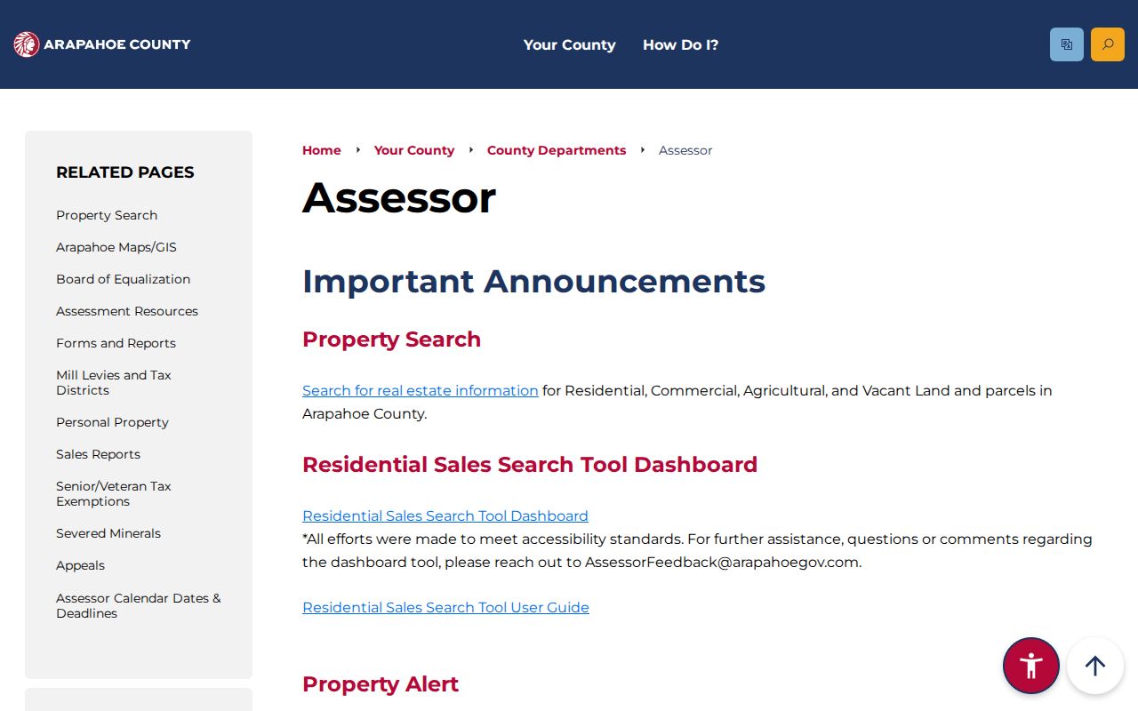
The office contact helps when an address result is incomplete or a parcel needs a PIN or AIN route.
| Field | Entry | Exact notes |
|---|---|---|
| AIN | Real-estate identifier | Up to 16 characters; preserve the format 0000-00-0-00-000, hyphens, and leading zeroes. |
| PIN | Numeric parcel identifier | Up to 16 numeric characters; state-assessed property is not available through the address path. |
| Number | Street number | Use with Street Name; keep the original number separate from a normalized version. |
| Range from/to | Number range | Supports a whole-street or address-range search when the exact number is uncertain. |
| Street Name | Street text | At least three characters are required; the form does not ask separately for direction or street type. |
| Unit | Unit or suite | Review multi-family or commercial matches and do not accept only the first assessor record. |
Search and Reset actions are available. Omit number and unit for a whole-street search, then narrow by parcel ID, jurisdiction, or returned address. The web interface did not expose a current owner-name search, so name-to-parcel work belongs in the recorder index or an official request.
The Arapahoe assessor parcel search is the operational address form used after the records hub has supplied the right county route.
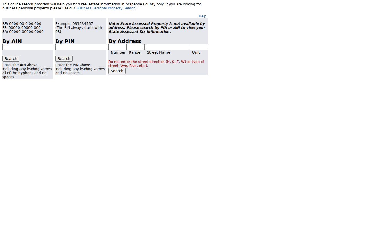
The parcel search can return a street inventory, but review identity when a property has several units, situs records, or a multipart shape.
Littleton Street Maps and Parcels
Arapahoe GIS Location Info accepts a street address without city, state, or ZIP, or a Parcel ID/PIN. Results can return jurisdiction, districts, parcel and assessor context, and tax status. The app uses a representative point or centroid to determine districts. Large or multipart parcels can cross a boundary, several situs records can exist, and the first assessor record may not be primary.
Use Location Info as a second check after the city wizard, especially when a mailing city differs from the county result.
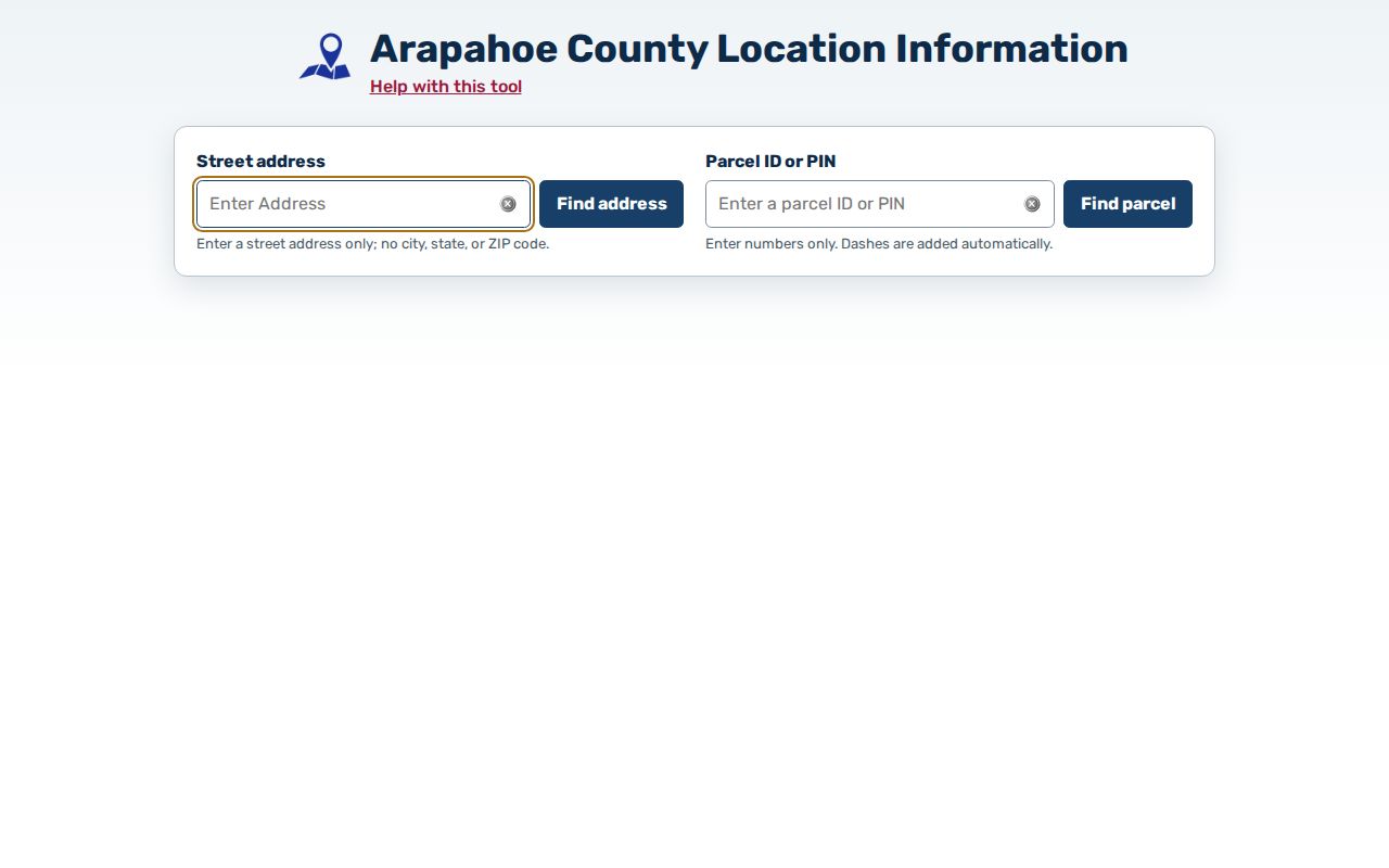
Anchor the result with the parcel ID, and record the map date and centroid caveat beside any district or school detail.
The county GIS hub describes ArapaMAP as a public viewer with more than 100 layers, parcels, aerials, streets, measurement, locate, redline, and print tools. Its parcel locator accepts a full or partial AIN/PIN. A partial AIN such as 2077-16-2 can find records beginning with that prefix, while a nine-digit PIN begins with 03. A statewide parcel service adds comparison fields such as situsAdd, ownerAdd, and landAcres, but the local assessor remains the parcel authority.
ArapaMAP adds street shape and nearby parcel context without turning a map point into a person profile.
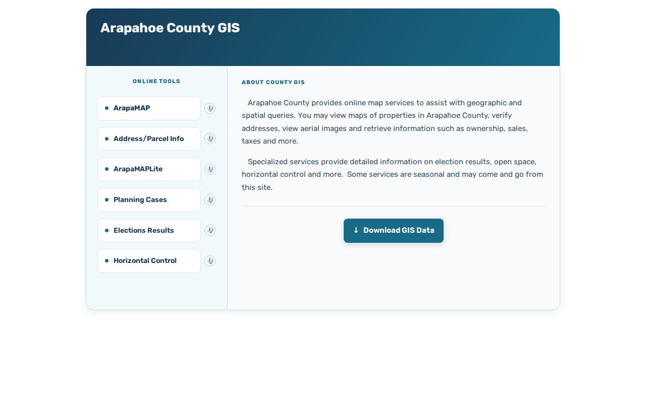
Use the viewer for adjacent-parcel geometry, then verify ownership and legal descriptions through the assessor or recorder.
Littleton’s neighborhood map is a dynamic ArcGIS Zone Lookup app, not a static list. A mapped zone is not automatically a legal subdivision or city boundary.
The city’s Homeowners Associations page links informational meetings, a questionnaire, the DORA HOA Information Center, the Secretary of State business search, and an ArcGIS dashboard. Treat those results as informational, not proof of a recorded covenant or association.
Littleton Permits by Address
Littleton’s current municipal trail has two online paths. eTRAKiT supports permit and development searches by permit number and address, payment, construction tracking, inspections, plan review, anticipated issue date, and zoning-verification letters. Many submissions need an applicant account. Archived permits may require the City Clerk, with address, project number, contact, and date range.
The city’s 2026 Development Activity List is a rebuilt ArcGIS application. Search by address or project, filter activity and status, and open a parcel for projects, documents, and meetings. The city says publication is discretionary and not comprehensive. It is a lead generator, not a full permit history.
Code Compliance uses the Address Wizard for location checks and offers 24/7 SeeClickFix reporting, codecompliance@littletongov.org, in-person service at 2255 W Berry Ave, and non-emergency phone 303-795-3758. Ask for the case or violation number, address, date range, and disposition or status. A courtesy notice can lead to inspection, follow-up, notice, or a municipal-court summons, and resolution can take about two weeks to several months. A complaint is not a finding. Use the recorded status and final action language.
Littleton Street Names Across Time
Older address work can fail when a street name or number changed. The historic survey identifies 1905 as the earliest Littleton directory found with specific addresses, while earlier sources may lack numbers. It notes gaps in the 1910s, 1920s, and early 1940s, plus rural addresses that may not appear. The 1961 grid changed 144 N Lincoln Ave to 5652 S Spotswood St. Search both forms, the block, and nearby landmarks.
The Littleton Museum’s Crocker biography documents the 1961 renaming of Grant Street to Crocker Street. Pair an old name with a directory, survey, deed, or period map before using a current parcel result.
- Record the directory year, edition, spelling, address, telephone if present, and printed label.
- Compare the address with the survey and 1961 conversion before matching a current parcel.
- Use a period map, such as the 1893 Littleton Sanborn sheets, for block context.
- Add a newspaper, obituary, church, cemetery, or local-history citation.
- Finish with recorder, transfer book, assessor, or GIS data; appraisal cards may be inaccessible.
Bemis Public Library, the Columbine Genealogical and Historical Society, the Littleton Museum, Denver Public Library, History Colorado, and State Archives fill different parts of the older street record. Bemis searches local history; the Society hub points to local indexes. Littleton Independent microfilm is listed at the Museum, Denver Public Library, and History Colorado. Historical volumes belong with the Littleton city directory collections, but a dated listing is not current ownership.
Address terms.
- Parcel
- A county-mapped land unit identified by an AIN or PIN. It describes assessment context, not every user.
- Situs address
- The physical address attached to a parcel. It can differ from a mailing address or have multiple records.
- Plat
- A recorded map or subdivision document for lots, streets, easements, and legal descriptions.
- Criss-cross directory
- An address-organized directory connecting a street, householder, and dated listing. Check its legend.
Littleton Deed Chains by Address
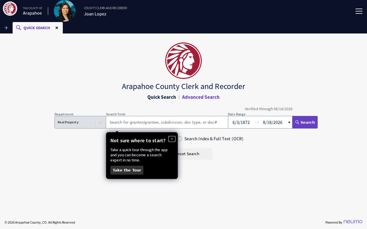
Use Arapahoe PublicSearch for the real-property index. Quick Search accepts a grantor or grantee, subdivision, document type, or document number, with two recorded-date fields and ranges from the last 24 hours through the last year. Choose index-only or index plus OCR/full text. The index was reported verified through July 29, 2026, with a runtime span through August 18, 2026 when checked.
Capture reception or document number, recorded date, document type, parties, legal description or subdivision, and book/page or image identifier. The PublicSearch portal is the deed-index source for an address chain.
Read the document type before describing an event. A deed may show an owner at a transaction date. A deed of trust is a security instrument, while a release, lien, or judgment records a different event.
Name indexing is described as available from 1980 forward. For pre-1979 material, ask recording@arapahoegov.com for a reception number or Book/Page, or arrange a branch appointment. The legacy Kofile QuickLink index exposes type, year, party, name, and book, volume, and page fields, including a visible 1860-1902 range. Confirm an old hit with the Clerk and Recorder.
A free GovOS account is required for digital access. Watermarked downloads were free, no-watermark copies were $0.25 per page, and certified copies added $1 per document plus $0.25 per page. Fees can change.
Littleton Voter Records by Street
The Colorado Find My Voter Registration lookup is an individual check, not a street search. It requires First Name, Last Name, ZIP, and Birthday in mm/dd/yyyy, with the name entered as shown. Confidential records and records for people under 18 may not appear. After a move, try the last home ZIP; unresolved cases belong with county staff.
For a whole-street view, use the Arapahoe voter-lists page. Posted comma-delimited files can include name, residence or mailing fields, status, party preference, voter history, voter ID, precinct, and districts. The basic active list was described as updated each weekday except holidays. Protected records, SSN, driver-license or state-ID numbers, electronic signatures, email addresses, and ballot selections are excluded.
Arapahoe Elections is at 5334 S Prince St, Littleton, with 303-795-4511, fax 303-794-4625, elections@arapahoegov.com, weekday 8-4 service, and appointments. The custom form selects precinct or district, party, status, and election history. Posted prices were $25 for comma-delimited output, $35 for Excel, and $0.25 per printed page. A Secretary of State PDF supplies a separate mail, email, fax, pickup, and payment route. Save the download date.
Littleton ZIP Overlap in Street Searches
Littleton’s official ZIP table is a jurisdiction clue, not a boundary source. ZIP 80120 is completely within city limits. ZIPs 80121, 80122, 80123, 80127, and 80128 are partial. ZIPs 80124, 80125, 80126, 80129, and 80130 are listed outside city limits. ZIPs 80160-80163 are PO Box products and 80165 is listed as discontinued. The overlap reaches Arapahoe, Jefferson, and Douglas County contexts and includes USPS places such as Centennial, Greenwood Village, Bow Mar, Columbine Valley, Denver, Lakewood, TrailMark, Roxborough, and Highlands Ranch.
Use the USPS ZIP Lookup for delivery formatting and ZIP+4, then compare the city’s Littleton ZIP Codes table with the Address Wizard and county parcel result. USPS describes a ZIP place name as a delivery-unit label, not a municipal boundary. A post office location, including the Littleton station at 5753 S Prince St, cannot assign a parcel to a city.
When a street result crosses a ZIP line, preserve the mailing city, municipal result, county, parcel ID, and record custodian separately. That USPS-city-parcel comparison prevents a postal label from changing a deed, permit, voter, or tax search.
Request Missing Littleton Address Records
When an online result stops short, use the custodian’s request path. The city’s Open Records Request policy says a Littleton CORA request should name the address, record type, date range, and desired fields such as permit number, inspection, final status, zoning letter, or code closure. The City Clerk permits inspection at Littleton Center, 2255 W Berry Ave, and may release PDFs. The city describes a three-working-day response, a possible seven-day extension, $0.25 per page, $2 per certified record, $40 per hour after the first research hour, $5 for CD/DVD, postage, and a possible 100% deposit.
Use the policy page as the current intake route. The printable 2022 PDF supplies mail and fax concepts, but its fillable fields need verification. Permit questions go to permits@littletonco.gov, development-review questions to DRT@littletongov.org, and archived permits may require the City Clerk. Medical, scholastic, privileged, deliberative, court-protected, and other exempt material may be withheld or redacted.
For county records, send a parcel ID or AIN/PIN and name the office. Arapahoe NextRequest can route county-held material. The Clerk and Recorder accepts PublicSearch, the 5334 S Prince St branch, mail, 24-hour red drop boxes, and approved eRecording. The current locations and hours page says branches operate 8:00 a.m.-4:00 p.m. effective January 1, 2026, with weekday appointments; an older recording page still shows 7:00 a.m.-4:00 p.m. The assessor accepts assessor@arapahoegov.com, 303-795-4600, office visits, and its address-change form. Courts remain with the Judicial Branch.
- State the address, parcel identifier, custodian, record type, and date range.
- Ask for the existing record or fields, not a custom conclusion about a person or property.
- Choose portal, inspection, email, mail, fax, drop box, or in-person delivery as the office allows.
- Keep the request, response, redactions, fees, deposit, and source date with the address trail.
What a Littleton Street Directory Cannot Show
A parcel result can identify a county land record. A deed can identify parties to a recorded transaction. A voter row can show public registration fields. None of those facts automatically establishes everyone who lives at an address. An owner is not automatically an occupant, and a directory entry may describe a dated business, boarder, or mailing connection. Confidential voter records, records for people under 18, and protected fields may not appear. DMV address data is not an informal lookup source.
Lawful use. Address records support personal, lawful research such as family history, parcel history, civic record checks, and reconnecting. Do not use an address result to stalk, harass, intimidate, or publish private mailing data. Treat each record as limited evidence and confirm important facts with the office that holds it.